
With Google Maps you can measure distances as the crow flies. In this tip you can read how to measure the distance between two or more points, without planning a route. Handy if you're at home and want to know how far your best friend lives from you, or if you need to determine a travel allowance as the crow flies.
Google Maps: measure distance as the crow flies
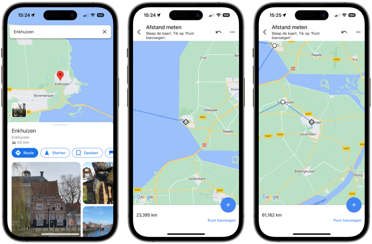
With Google Maps you can plan routes and find all kinds of information about locations. But the navigation app also has a somewhat hidden function to measure distances as the crow flies. In a few taps you can measure the distance between two or more points. Normally, Google Maps only takes into account travel distances between A and B, measuring the (sometimes winding) route by car, bicycle, public transport or on foot. The straight-line distance does not take the road network into account and shows you the actual distance.
As the crow flies in Google Maps
Measuring distance is easy. Here's how it works:
- Choose the starting point: press and hold your finger on the first location to set a red pin.
- Swipe up on the information panel about the location and choose for Measure Distance.
- Move the map to the desired destination.
- Tap the plus sign at the bottom right to add a point.
- Add more points if necessary please.
- At the bottom of the screen you see the total distance, in this case 4.4 kilometers.
![]()

You can remove the last point by tapping the Undo symbol (an arrow pointing back) at the top of the screen. To delete all points, tap the three dots at the top right and then Delete. When you're done, tap the back button at the top of the screen and you're back in the normal Google Maps interface. This way you can also make a creative drawing, for example by putting all kinds of dots in a row.
We have many more tips for Google Maps:
- Parking location of your save your car in Google Maps, this is how you do it
- Plan public transport route with Google Maps for iPhone
- Cycling with Google Maps: this is how you use the bicycle view


Google Maps is more versatile than you think: you can do this on iPhone and iPad
Google Maps on the iPhone and iPad offers almost the same possibilities as on the desktop. But how do you use Google Maps? In this tip you can read how to set a route, view Streetview and the satellite view or request traffic. In short: everything you want to know.