With iOS 15, a heavily revised version of Apple Maps was introduced, which introduces 3D maps with numerous details and improved navigation. In the beta phase only available in San Francisco, the new 3D maps are currently also available for London and other US cities. Canada should follow next year.
The 3D maps were initially only offered for San Francisco in the first beta version of iOS 15. Since the final iOS 15 was available last week, new maps of London, Los Angeles, New York City and the San Francisco Bay Area have been offered to all users, according to Apple. On three iPhones with iOS 15, however, the editors are only able to see the new 3D maps in San Francisco and New York City, while London and Los Angeles are not yet using the new models, such as those shown by Apple in London using the Palace of Westminster .
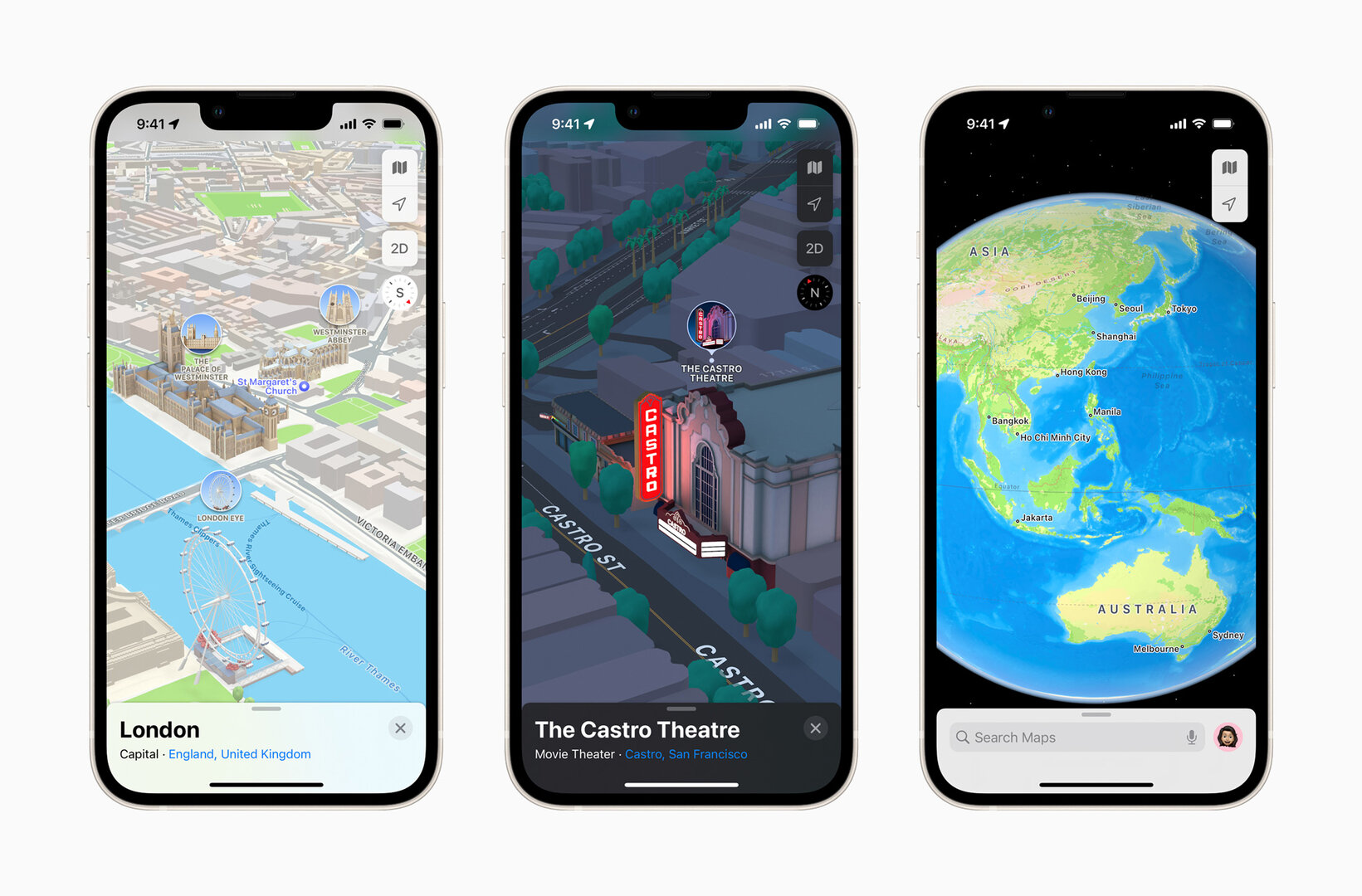 The new Apple Maps in London and San Francisco ( Image: Apple)
 Canada will get 3D cards next
This year Apple plans to have updated 3D maps in the USA for Philadelphia, San Diego and Washington, D.C. as the company announced today. It was also announced that in the coming year Montreal, Toronto and Vancouver in Canada will be supplied with new map material. 3D maps for other cities that have not yet been named are to follow over time.
Apple is passing Google in part
The availability of the new 3D maps due to their time-consuming development is currently the greatest limitation of the new Apple Maps. Apart from London, the new map material is not available for any European city. The quality of the maps, which have been completely redesigned over several years, is absolutely convincing, as is shown by a comparison of several map excerpts made by ComputerBase with Apple Maps from iOS 15 and iOS 14 as well as Google Maps shortly after the presentation of the new app at the WWDC developer conference showed.
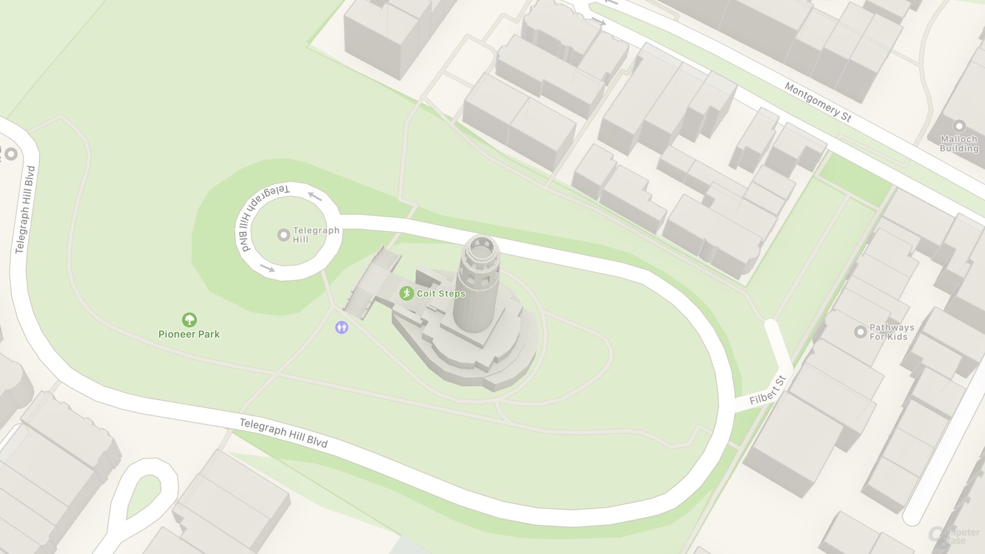
 Image comparison: SF Coit Tower (iOS 14) ⇔ SF Coit Tower (iOS 15)
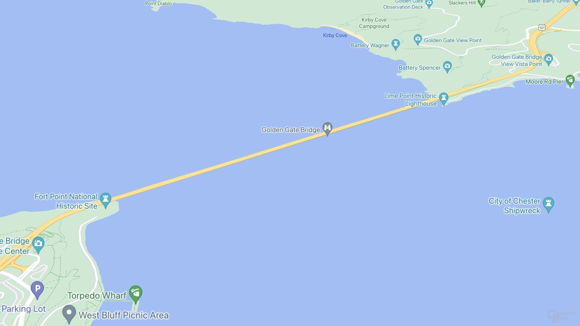
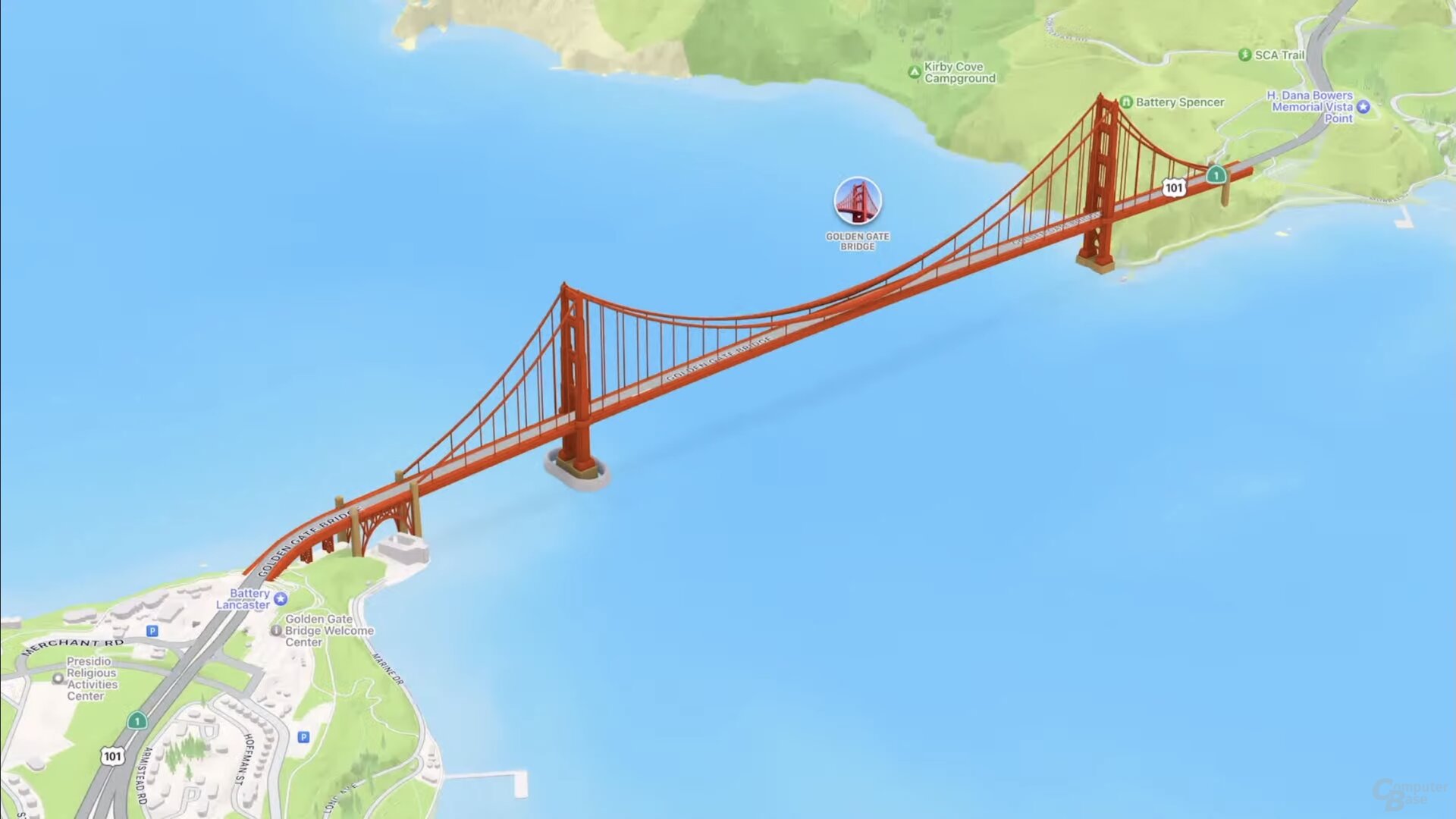 Image comparison: SF Golden Gate Bridge (Google Maps) ⇔ SF Golden Gate Bridge (iOS 15 )
 Cards with graphics like in games
The new view does not correspond to classic map material, but has similarities to game worlds such as from “The Sims”. Apple is putting much more effort into the three-dimensional design, incorporating more details about buildings and nature and for the first time also showing differences in height, as can be seen around Telegraph Hill in San Francisco. So far, the Coit Tower was on the same level as neighboring residential buildings, the hills of which were also missing. Apple Maps doesn't have to shy away from a comparison with Google Maps. In terms of display quality, Apple delivers the better result – at least in this city. Apple's map material simply looks nicer and even on Google the characteristic height differences of the city and the vegetation are missing. You have to give Google credit for the very high density of information about shops, sights and co.
New navigation by car, public transport and on foot
The new Apple Maps in iOS 15 also brings with it a greatly enhanced navigation system that makes individual lanes and exits clearly recognizable and, above all, also renders road overpasses three-dimensionally and thus clearly separated from your own route. Important cross connections are also displayed to the driver. And again, the height differences help to better classify the current position. Apple plans to offer this new navigation for CarPlay later this year as well.
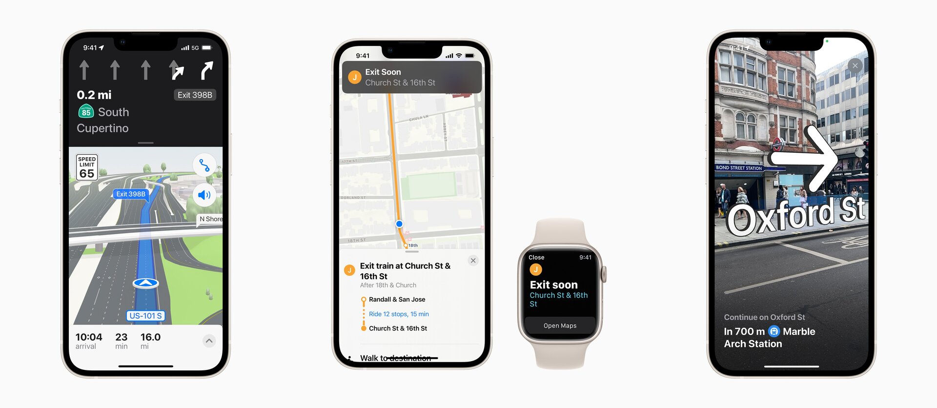 New navigation with car, public transport and on foot (Image: Apple)
 There are also improvements for public transport, where there are stops and train stations can be displayed in a new list view in the immediate vicinity and popular connections can be pinned. Apple Maps “tracks” the user while driving and reminds them to get off at the next stop in good time. For navigation on foot, there is an AR-supported live view with POIs in the camera's viewfinder.